1
/
von
1
mysite
1962 Pano-View Map - California & Nevada
1962 Pano-View Map - California & Nevada
Normaler Preis
$55.00 USD
Normaler Preis
$60.00 USD
Verkaufspreis
$55.00 USD
Grundpreis
/
pro
Inkl. Steuern.
Versand wird beim Checkout berechnet
Verfügbarkeit für Abholungen konnte nicht geladen werden
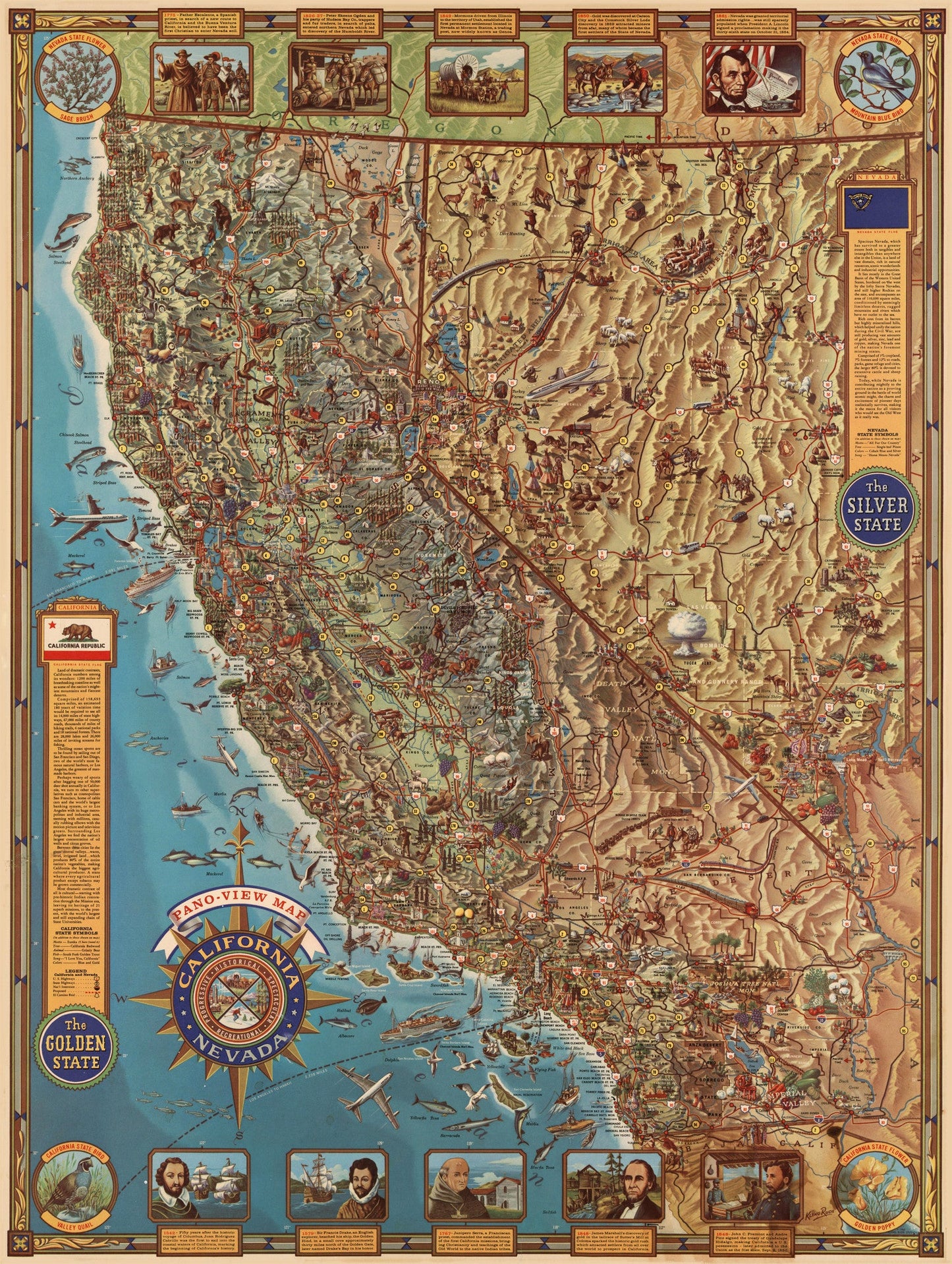
By: Klengston?Rude
Date: 1962 (dated) Long Beach, CA
Original Size: 32 x 24 inches (81 x 61 cm)
This is a wonderful reproduction of the highly sought after pictorial map of California and Nevada by Klengston Rude. This map is so filled with images that it defies description, one must view it to appreciate it. Rude took great pains to include history in his imagery, and vignettes along the top and bottom of the map, fourteen in all, picture and describe important people and events. Starting in 1552 with the voyage of Juan Rodriguez Cabrillo, who is thought to be the first European to sail into the coastal waters of California, through 1861 when Nevada was assigned territorial rights and then 1864 when President Abraham Lincoln signed a proclamation making it the thirty-sixth state, the vignettes provide a brief history of the states.
Industry, agriculture, local customs, early Spanish architecture are among the most prominent features, but the map is so filled with images that describing it doesn't do it justice. People from every walk of life are depicted, at work, at leisure... including industrial workers, hunters, fishermen, farmers and cowboys to name a few. Geographical features are depicted and named. Flora and fauna of every sort are represented. Agricultural products abound, including grapes and the wine made from them, and wildlife of both states depicted everywhere. This marvelous reproduction is not only decorative, but highly informative as well.?
Inventory #81006
Share