mysite
1931 An Illustrated Map of Chicago...
1931 An Illustrated Map of Chicago...
Precio habitual
$55.00 USD
Precio habitual
$60.00 USD
Precio de oferta
$55.00 USD
Precio unitario
/
por
Impuestos incluidos.
Los gastos de envío se calculan en la pantalla de pago.
No se pudo cargar la disponibilidad de retiro
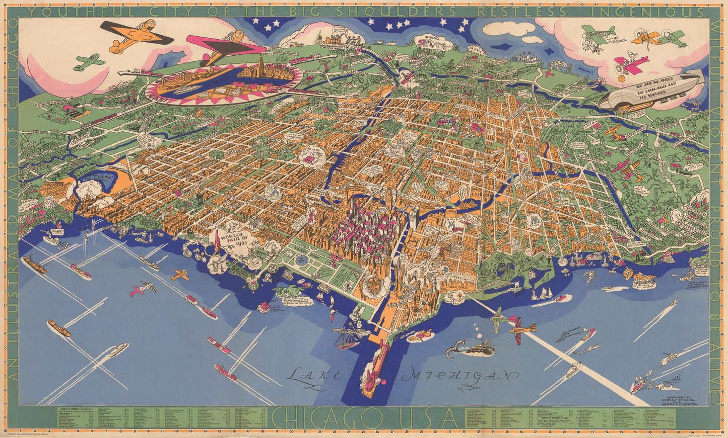
An Illustrated Map of Chicago, Youthful City of the Big Shoulders ¨C Restless ¨C Ingenious ¨C Wilful ¨C Violent ¨C Proud to be Alive
By: Charles Turzak & Henry Chapman?
Date: 1931 (dated) Chicago?
Original Size: 22.5 x 37.5 inches (57.15 cm x 95.25 cm)
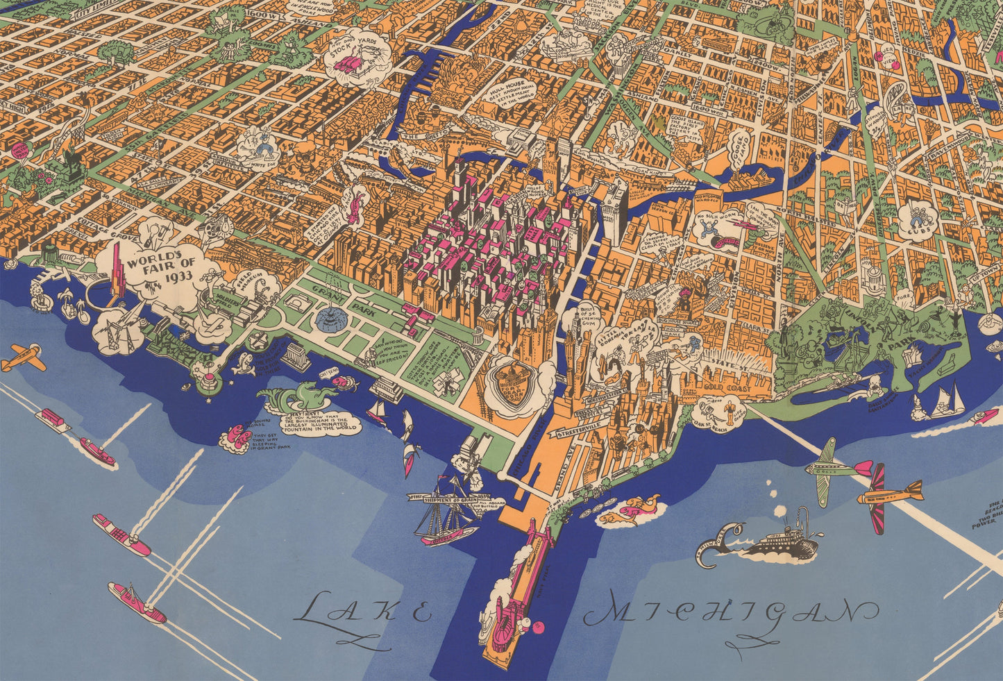
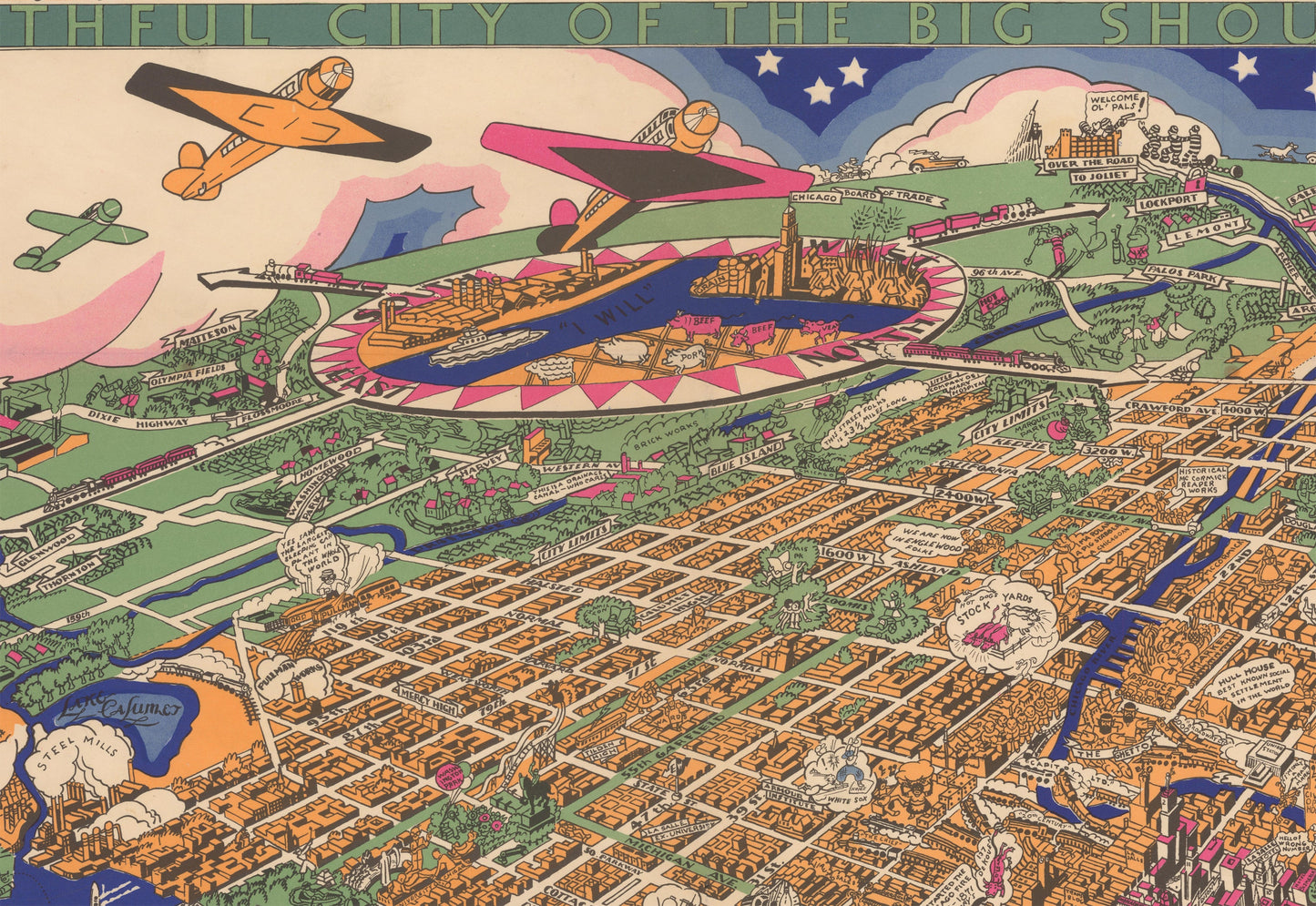
This is a superb example of Turzak & Chapman¡¯s iconic map of the city of Chicago. Presented with a bird¡¯s eye view or the city from Lake Michigan, this joyous pictorial map is rich in detail, color, and humor.
While Chicago in the 1930s is most notably remembered for being overrun with organized crime, this map illustrates a very different representation of the city. It focuses more on tourist activities, landmarks, professional sports teams, diversity of neighborhoods, and an overall energetic lifestyle of Chicagoans.
The map was originally made with the intent of promoting the 1933 World¡¯s Fair, which can be seen along the lake just south of the Field Museum and Soldier¡¯s Field. Some landmarks worth noting include the site of Fort Dearborn, Chicago Stock Yards, Joliet Prison, Aurora Racetrack, Riverview Amusement Park, and the large number of theatres in the downtown loop district, which are indicated with faces of Comedy and Tragedy. The limits of Chicago are represented in orange, with all parks, boulevards, and surrounding suburbs colored green.
Inventory #10741
Share