1
/
van
1
mysite
1588 Chinae, olim Sinarum regionis nova descriptio auctore Ludovico Georgio.
1588 Chinae, olim Sinarum regionis nova descriptio auctore Ludovico Georgio.
Normale prijs
$369.00 USD
Normale prijs
$374.00 USD
Aanbiedingsprijs
$369.00 USD
Eenheidsprijs
/
per
Belastingen inbegrepen.
Verzendkosten worden berekend bij de checkout.
Kan beschikbaarheid voor afhalen niet laden
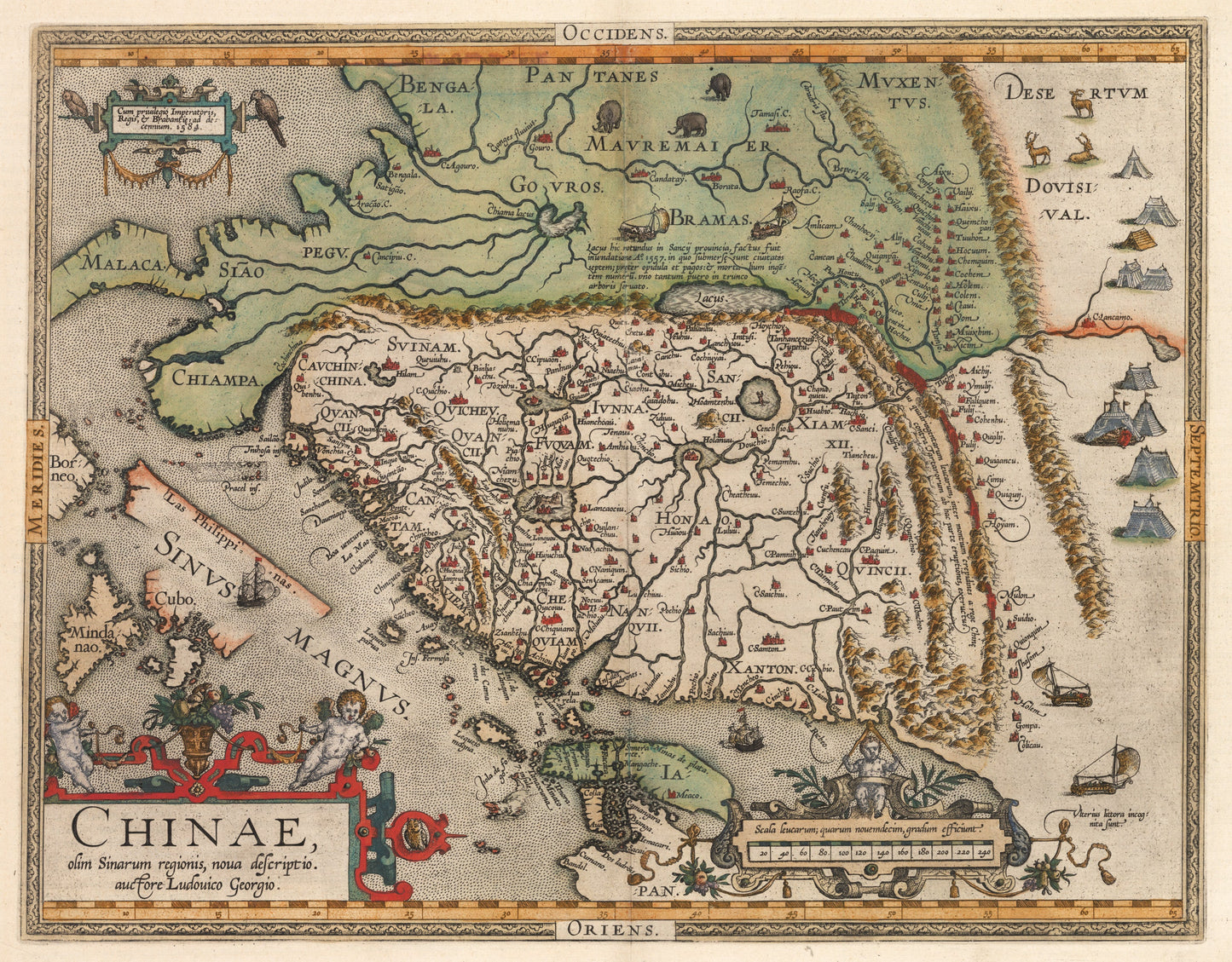
By:?Abraham Ortelius
Date:?1588 (Published) Antwerp
Original Size:?14.35 x 18.5 inches (36.45 x 47 cm)
This is a fine print reproduction of the earliest known European map to focus on China. This example is of the second state of Ortelius¡¯ map of China, the first map of China to appear in a western atlas. The map is oriented to the west, with north to the right.
The map is taken directly from reports of the Portuguese mapmaker Luis Jorge de Barbuda (Ludovicus Georgius), who made a manuscript map of China which reached Ortelius via Arias Montanus. Some geographic points of interest include false lakes in Asia's interior and the Great Wall separating the Chinese from the Mongolian tribes to the north. Small vignettes show wind?powered charriots in the lower right portion of the map.?
First published in 1584, Ortelius' map of China is the earliest western printed map to focus on China and the first to illustrate the Great Wall of China, though only a small section of it. Richly detailed, the map provides significant information regarding an area of the world which was little known to the West. Tooley referred to the map as the standard map of the interior of China for over sixty years.
Inventory #11229
Share