mysite
1931 The Fox River Valley of Wisconsin, 1634 - 1880
1931 The Fox River Valley of Wisconsin, 1634 - 1880
Kan beschikbaarheid voor afhalen niet laden
By:?Nile Jurgen Behncke
Date:?1931 (Dated) Oshkosh, WI
Original Size:?27.25 x 24.5 inches (69 x 62 cm)
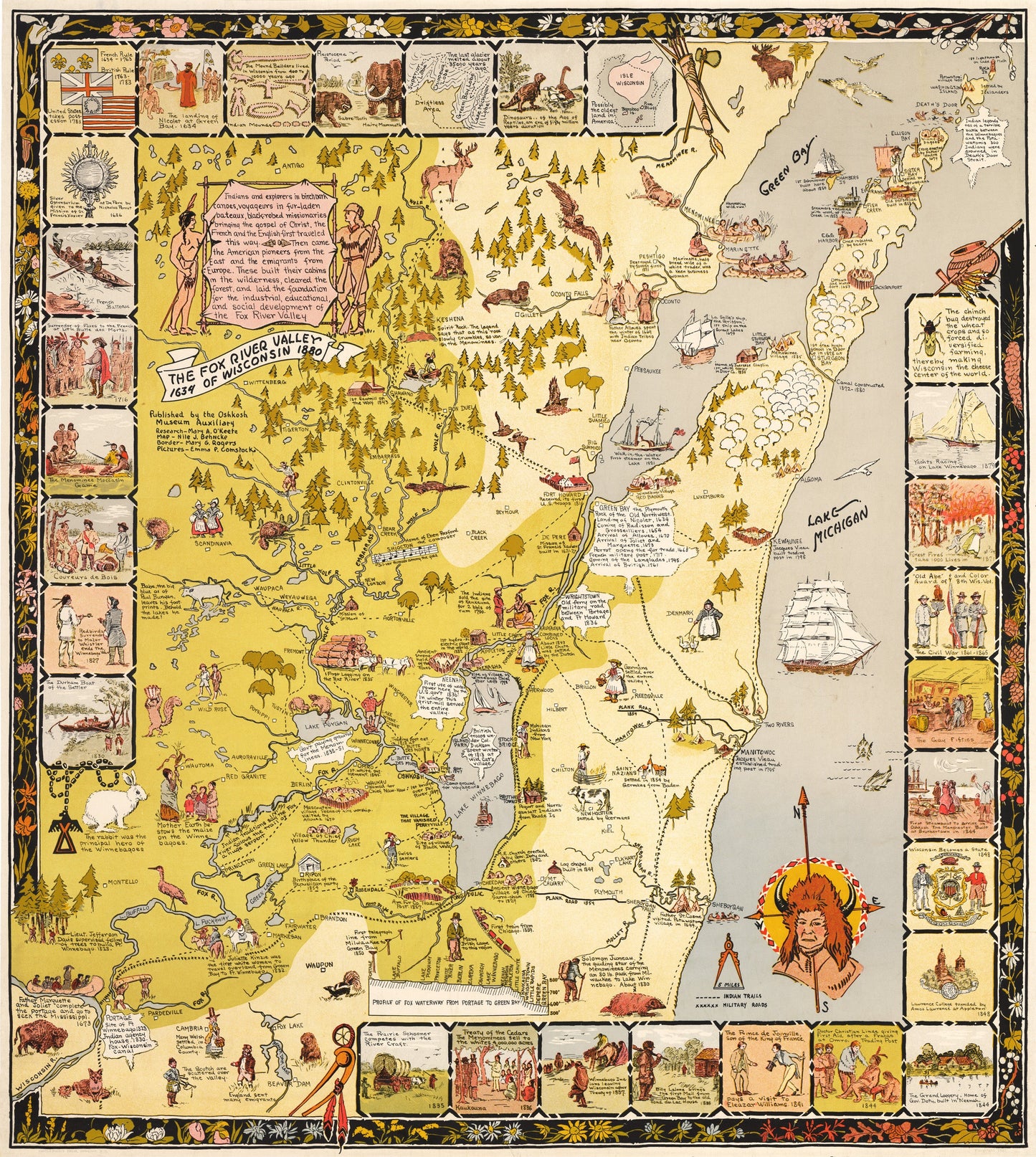
This is a fine print reproduction of an exciting pictorial map of the Fox River Valley of Wisconsin, created in 1931 by Nile J. Behncke, published by the Castle-Pierce Printing Co. and sponsored by the Oshkosh Museum.
The map is quite scarce with WorldCat lists it being held in just two libraries in the state of Wisconsin. Centered on Lake Winnebago and Green Bay, the map extends as far southwest as Portage and northeast to Rock Island, the furthest island of the Door County archipelago. The map celebrates the flora, fauna, culture, industry, and history of the of the Fox River Valley in a pictorial style most reminiscent to that of Jo Mora, who was producing similar maps around the same time.
Bordering much of the map are 29 boxed illustrations that provide a visual timeline of the area from the time of the Dinosaurs to the 1860s-70s when tiny insects known as chinch bugs began devouring Wisconsin wheat crops. As a result of the devastation the bug had along with the dropping price of wheat, the area as well as much of the state made the switch to focus their agricultural practices on dairy, which of course is now what the state is most known for producing. Surrounding the map is a floral boarder that features a variety of wildflowers found within the Fox River Valley.
Inventory #10965
Share