mysite
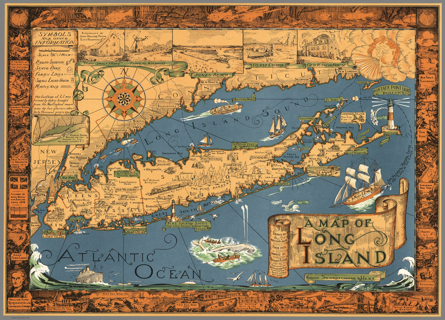
1933 / 1961 A Map of Long Island
1933 / 1961 A Map of Long Island
Couldn't load pickup availability
By: Courtland Smith (published by the Billboard Barn)
Date of Original: 1933 / 1961 (Dated) Southampton, New York?
Original Size: 19.5 x 27 inches (49.5 cm x 68.5 cm)
This is a fine print reproduction of a superb example of the 1961 re-issue of Courtland Smith¡¯s pictorial map of Long Island, from Brooklyn and Queens to the Hamptons and Montauk. Landmarks such as Montauk Lighthouse, the beach at Southampton, and the Fire Island Light, Jones Beach, and Coney Island are shown along the south shore.
The Atlantic Ocean and Long Island Sound are decorated with various pictorial illustrations including a striped bass, swordfish, spouting whale, the Sag Harbor Whaler ship, and a Boston Boat. The border is intricately decorated with underwater scenes at the top and important sites and historical scenes on the sides and bottom, that include the settlement of Brooklyn and building of Brooklyn Bridge, Rum Row (referencing prohibition), deep sea whaling, the building of the Monitor in the Brooklyn Naval Yard, and the initial discovery by Hendrick Hudson in 1609 to name a few.
A key just left of a magnificent compass rose indicates radio stations, state parks, ferry lines, small light houses, and mainland.
Inventory #19405
Share